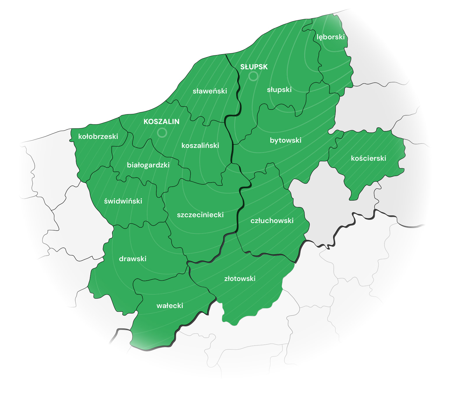
Słupska Specjalna Strefa Ekonomiczna (skrót: SSSE), zarządzana przez Pomorską Agencję Rozwoju Regionalnego S.A. z siedzibą w Słupsku, obejmuje swym zasięgiem atrakcyjnie zlokalizowane grunty inwestycyjne w środkowej części Pomorza. Strefa składa się z 18 podstref zajmujących łącznie ponad 910,1585 ha, położonych w województwie pomorskim i zachodniopomorskim. Wszystkie tereny inwestycyjne, objęte statusem specjalnych stref ekonomicznych będą funkcjonowały do dnia 31.12.2026 r.
Zgodnie z Rozporządzeniem Ministra Przedsiębiorczości i Technologii z dnia 29 sierpnia 2018 roku w sprawie ustalenia obszarów i przypisania ich zarządzającym (Dz. 2018, poz. 1698) teren całego kraju został objęty programem Polska Strefa Inwestycji. Obszar pozostający we właściwości Zarządzającego Słupską Specjalną Strefą Ekonomiczną obejmuje 16 powiatów, zlokalizowanych na terenie trzech województw: pomorskiego (5 powiatów i 1 miasto na prawach powiatu), zachodniopomorskiego (8 powiatów i 1 miasto na prawach powiatu) oraz wielkopolskiego (1 powiat). Obszar działania Zarządzającego SSSE to zachodnia część województwa pomorskiego (NUTS 3: podregiony słupski i chojnicki), wschodnia część województwa zachodniopomorskiego (NUTS 3: podregiony koszaliński i szczecinecko-pyrzycki) oraz jeden powiat zlokalizowany na północy województwa wielkopolskiego (NUTS 3: podregion pilski).
Oferta terenów
Podstref Słupskiej SSE
w województwie pomorskim:
- Słupsk-Włynkówko (100,2801 ha)
- Słupsk-Westerplatte (38,4683 ha)
- Redzikowo (63,3665 ha)
- Wieszyno (82,1608 ha)
- Ustka (9,1497 ha)
- Debrzno (9,8736 ha)
- Czarne (7,9157 ha)
- Lębork (18,7968 ha)
- Płaszewko (7,7796 ha)
w województwie zachodniopomorskim:
- Koszalin (150,1655 ha)
- Szczecinek (97,6339 ha)
- Wałcz (56,7961 ha)
- Polanów (37,0116 ha)
- Laski Koszalińskie (17,58 ha)
- Tychowo (5,0448 ha)
- Karlinko (180,0846 ha)
- Kalisz Pomorski (9,3866 ha)
- Darłowo (18,6643 ha)
Mapa obszaru we właściwości Słupskiej Specjalnej Strefy Ekonomicznej
w ramach Polskiej Strefy Inwestycji oraz podstref Słupskiej SSE

Szczecinek (97,6339 ha)
Koszalin (150,1655 ha)
Laski Koszalińskie (17,58 ha)
Polanów (37,0116 ha)
Wałcz (56,7961 ha)
Darłowo (18,6643 ha)
Karlinko (180,0846 ha)
Tychowo (5,0448 ha)
Kalisz Pomorski (9,3866 ha)
Słupsk-Włynkówko (100,2801 ha)
Ustka (9,1497 ha)
Redzikowo (63,3665 ha)
Słupsk-Westerplatte (38,4683 ha)
Debrzno (9,8736 ha)
Czarne (7,9157 ha)
Lębork (18,7968 ha)
Płaszewko (7,7796 ha)
